
IXEAN Lawin Urban
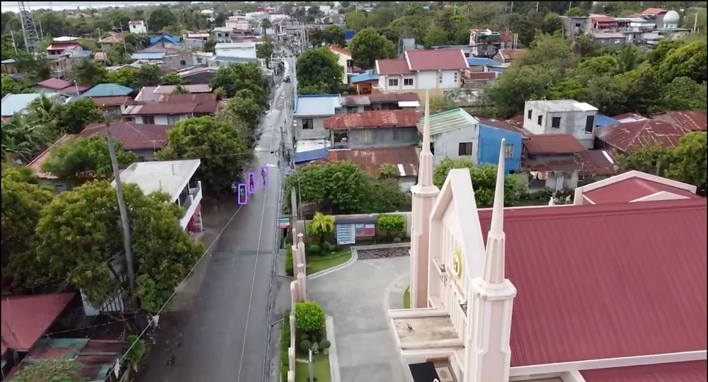
Monitoring large, densely populated metropolitan areas relies heavily on static CCTVs and ground patrols, both of which have critical limitations. Fixed cameras suffer from blind spots that are easily exploited, while foot patrols lack the speed, scale, and multi-target visibility that an aerial perspective provides. In high-density zones like bustling markets, ground agents are easily overwhelmed and operate at a disadvantage.
While high-definition camera equipped drones offer a strong alternative, traditional manual operations fall short in cities as vast as Metro Manila. Single-drone operation limits rapid sector assessment, demands multiple operators to achieve scale, and introduces human fatigue into critical surveillance loops. This bottleneck becomes especially dangerous during typhoon season, where rapid, wide-area coverage is essential for locating stranded populations in flooded zones.
This is where IXEAN’s systems bridge the gap.
Monitoring city blocks on the scale of Metro Manila requires advanced robotic autonomy, encompassing predetermined flight paths, facial recognition, AI-driven target tracking, and swarm coordination. The IXEAN Lawin Urban is our modular flagship solution engineered specifically for this use case.
The Lawin is a fully autonomous, medium-sized quadcopter designed to operate within a coordinated swarm for rapid area assessment. In practice, a fleet of N drones divides a city sector into equally sized subregions. Each unit traverses its assigned area using predetermined, street-following flight paths to bypass large structural obstructions. Utilizing advanced RGB and thermal cameras—each backed by proprietary state-of-the-art, onboard AI modules—the drones can detect and profile faces from high altitudes. Drones can be ordered to autonomously track targets within designated safety parameters, returning home automatically once regional diagnostics are complete. All data is streamed in real-time to the operator.
To manage the fleet, we will develop a comprehensive Graphical User Interface (GUI) that allows a single operator to command multiple drones simultaneously. The GUI will feature live sector mapping, GPS tracking, autonomous flight planning, point-and-click movement commands, live video feeds, and a manual FPV override.
A single Lawin Urban unit will feature four operational modes:
- Fully Autonomous: Executes grid searches or street-following paths.
- Tracking: Autonomously follows a designated target.
- Semi-Autonomous Command: Moves to and hovers above an operator-specified waypoint.
- Manual FPV: Grants the pilot full, first-person control of the drone.